My
Tesla
drive on Mojave Desert highways from Orange County, California, to
Randsburg, Mojave, Tehachapi RR Loop, Palmdale and back to Orange
County via Pasadena.Many non-Tesla
owners think that you cannot take a 400+ mile trip on state highways
(not Interstates) and have enough Tesla Superchargers to not run out of
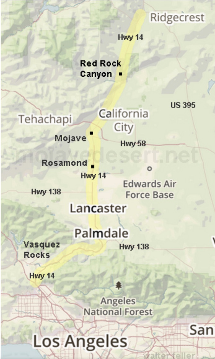
battery. As you can see from the "A Better Route Planner" below
you only need to charge at 3 locations - Hesperia, Mojave, and
Palmdale (counter clockwise on the map below). I charged more
times because I took a side trip to Tehachapi (left/west of
Mojave). Palmdale was my destination so I tried to use the Tesla
Supercharger in that city since it was only one block from my Hilton
Garden Inn where I stayed for a photo conference on Saturday, April 9,
2022.
Oh, by the way,
it cost me $26 for the 401 mile round trip.
(To see a
larger copy of most images, click the image.)
Randsburg is the red pin at the top of the circle. I
started at the red pin at the bottom.
The Tehachapi Loop is left
of Mojave (top left). The conference was at Palmdale.
My
drive started at the red pin at the bottom of the map above -
I-57 to I-60 to I-15 up Cajon Pass to the Hesperia Tesla
Supercharger. Then Hwy. 395 to Randsburg.
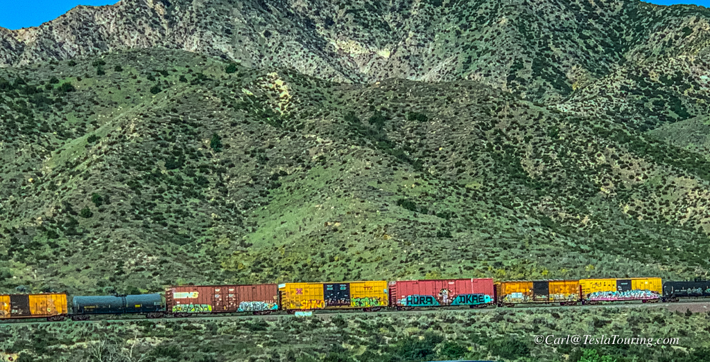
With Autopilot
(Adaptive Cruise Control and Lane Keeping) I had a few seconds to use
both hands to take this photo of a mixed freight train coming down
Cajon Pass.
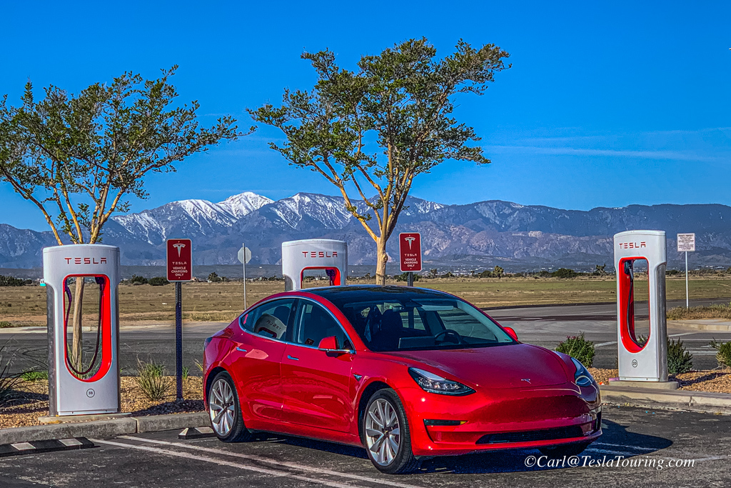
Hesperia Tesla
Supercharger with snow-capped San Bernardino Mountains as
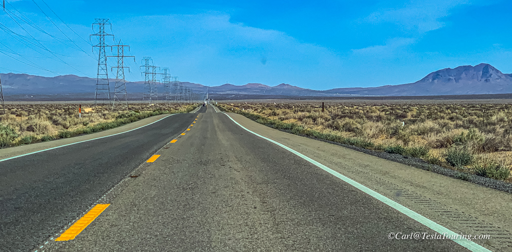
backdrop. Typical Hwy. 395 scenery, and traffic, north of Hwy 58.
Another view of Hwy. 395 near Boron, California.
.
The
Photographic Society of America (PSA)
held a conference in Palmdale, California , April 8 - 10, 2022. One
of the photo outings scheduled for Sunday was Randsburg,
California. However, I had other plans back home on Sunday, so I
ventured to Randsburg on Friday. Fellow PSA member, Donna Judd,
and I decided to meet there, 2 1/2 hours from our homes in Orange
County, at 10 a.m. at the General Store which has a cafe
inside. The agreement was, if one of us got there
before 10, they would start shooting some photos, then return to the
cafe to meet the other party. I arrived at 10:05 and parked
at the General Store, soon I spotted Donna's driver, Jenny, who had
arrived a few minutes before 10. I hopped in their car and Jenny drove
us to various photo spots in and around town, photos to follow.
Randsburg,
CA.
- Rand Camp began as a tent city, erected by eager miners rushed to
the Mojave desert following a major gold discovery in April 1895. A
year later, the town of 1,500 had been renamed "Randsburg." Saloons
sprouted, a U.S. Post Office was established, and the communities first
newspaper,"The Randsburg Miner," appeared. It is on the west side of
U.S. Route 395 between Kramer Junction to the south and Ridgecrest to
the north. Randsburg is in the Rand Mountains, and is separated by a
ridge from the neighboring community of Johannesburg. Both mine and camp
were named after the gold mining region in South Africa. The first post
office at Randsburg opened in 1896.
Randsburg
is a census-designated place in Kern County, California,
United States. Randsburg is located 17 miles south of Ridgecrest, at an
elevation of 3,504 feet. Randsburg has a cold semi-arid climate
(BSk) found on the western edge of the Mojave Desert with very hot, dry
summers and cool winters.
South of Suez,
starring George Brent and released in November 1940, was filmed in
Randsburg. The video for Calvin Harris's platinum single, Feel So Close,
was filmed in part in Randsburg. Dwight Yoakam's 1989 video for "Long White Cadillac"
was also filmed in the town.
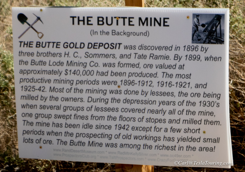
The
Rand Mining District was also called the Yellow Aster Mine
and the Kelly Mine. The mines started the town of Randsburg in 1895 and
later the town of Johannesburg, California and Atolia,
California. The Rand Mine produced more silver than any mine in
California. The mine closed in 1929 as it was no longer profitable.
In
January of 1898 Randsburg Railway opened. It ran from Johannesburg to
Kramer Junction, California with a stop at Atolia.
Rand
Mining District California Historical Landmark reads:
NO. 938 RAND MINING DISTRICT - The Yellow Aster, or Rand, mine was
discovered in April 1895 by Singleton, Burcham, and Mooers. The town of
Randsburg quickly developed, followed by the supply town of
Johannesburg in 1896. Both names were adopted from the profusion of
minerals resembling those of the ranch mining district in South Africa.
In 1907, Churchill discovered tungsten in Atolia. In June 1919,
Williams and Nosser discovered the California Rand Silver Mine at Red
Mountain. Tourism The
town has an influx of tourists throughout the year. Most visitors
arrive between autumn and spring due to the extreme heat in summer. The
annual Western Days Celebration starts in the third weekend of
September, where the town hosts events such as gun fights, panning for
gold, live bands, dances and vendors. During Thanksgiving and New
Year's Day weekend, off-roading enthusiasts visit via the town's legal
off-roading trail. Local shops are usually closed on weekdays, and open
during weekends.
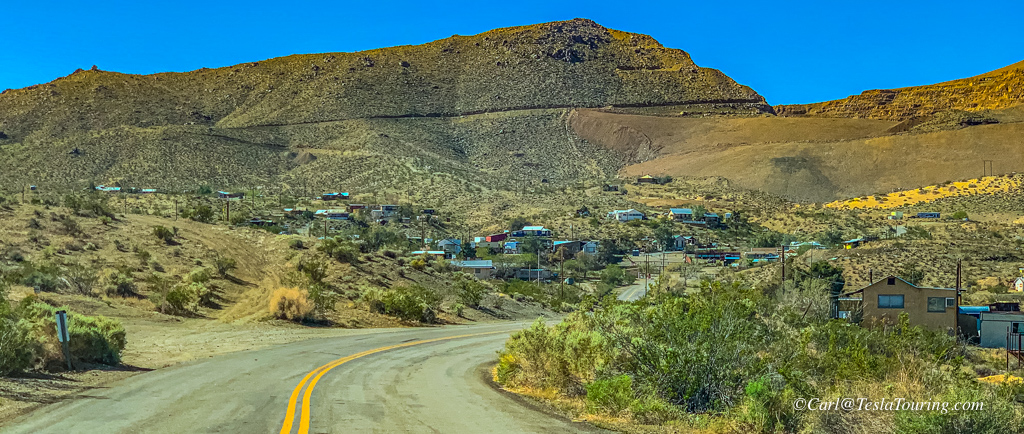
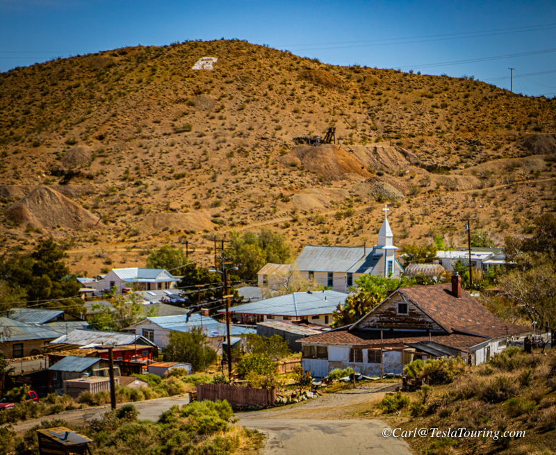
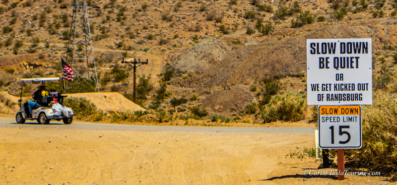
First view of Randsburg after turning off Hwy. 395.
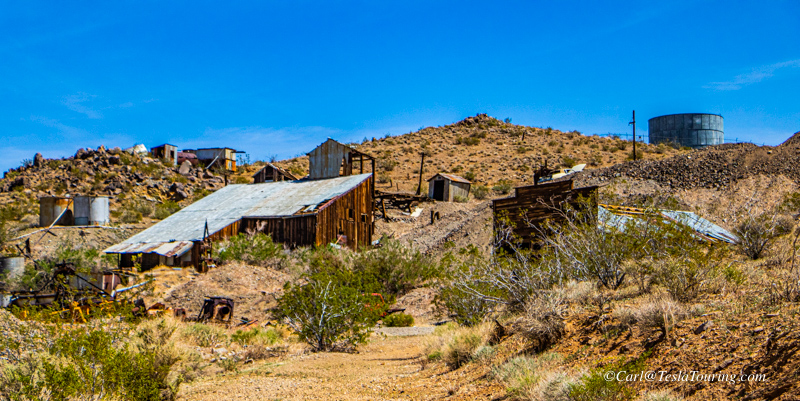
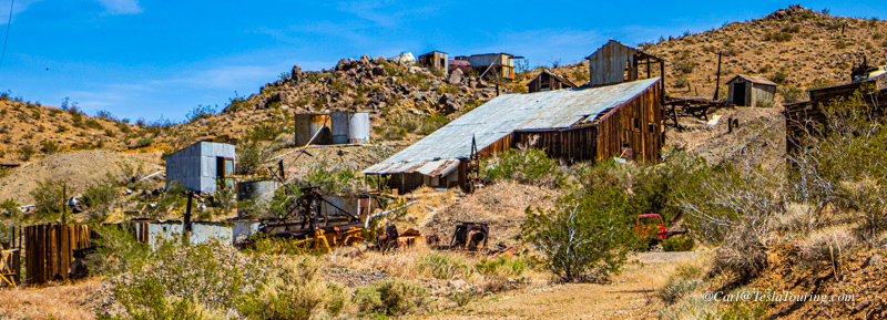
Evidence of current mining - working with tailings of old mines.
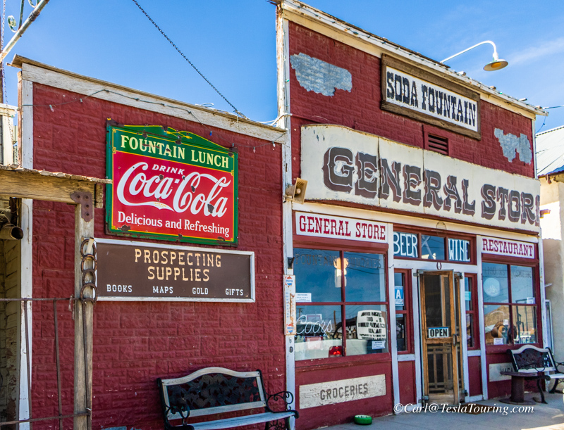
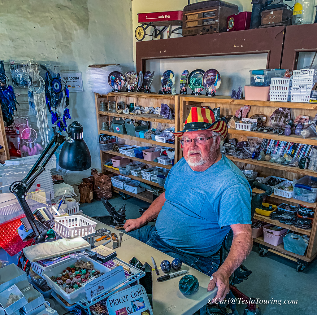
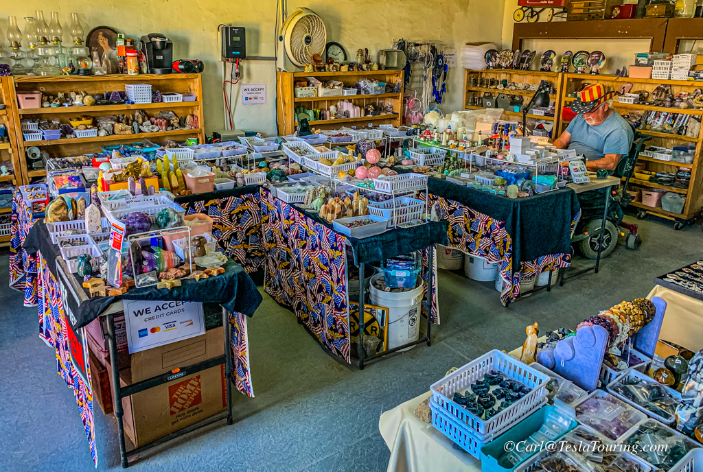
My
destination was the GENERAL STORE, above left. However, I parked
in front of the rock shop and the first person I met in town was Stephen P. Jones, above, rock shop owner.
Stephen was the friendliest guy in town. Stop in and check
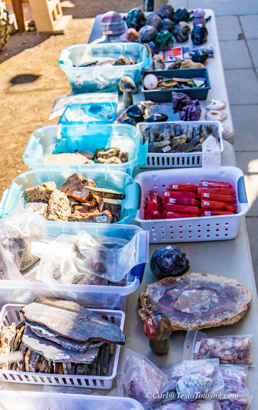
out his rock shop.
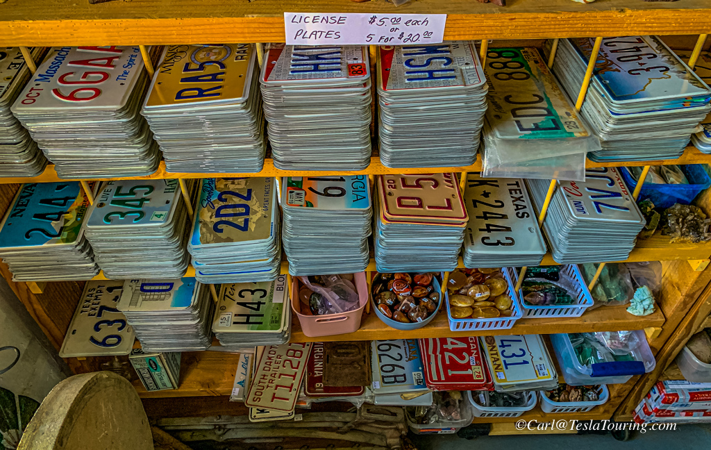
Stephen has an attractive display outside and hundreds of license
plates in the corner of his shop.
Stephen's business card reads: firerosedesigns.com
Rock Shop 169 Butte Ave. P.O. Box 127, Johannesburg, CA 93528.
Cell: 831-917-7757 stephen.jones.1950@gmail.com Buy, Sell, Trade
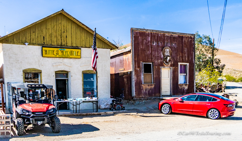
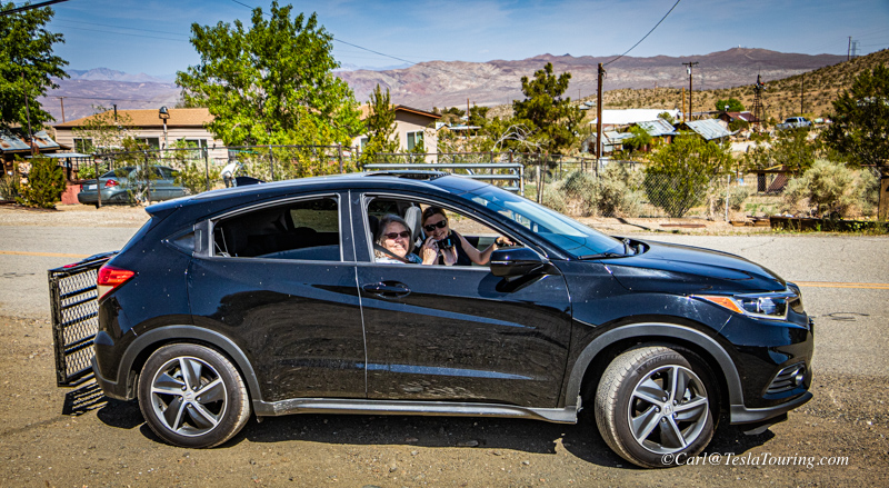
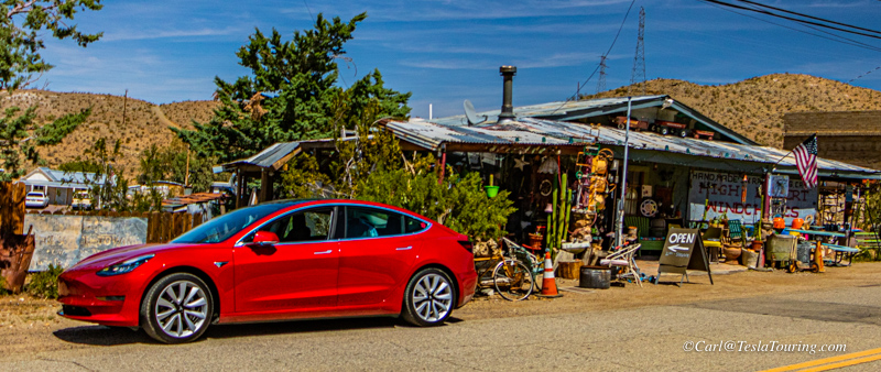
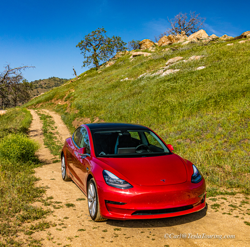
Butte Rock Shop on the left; The red Tesla I arrived in town in on
the right. Above right, Donna Judd with driver Jenny,
as we began looking for photogenic items in Randsburg.
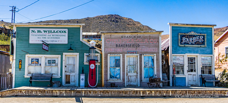
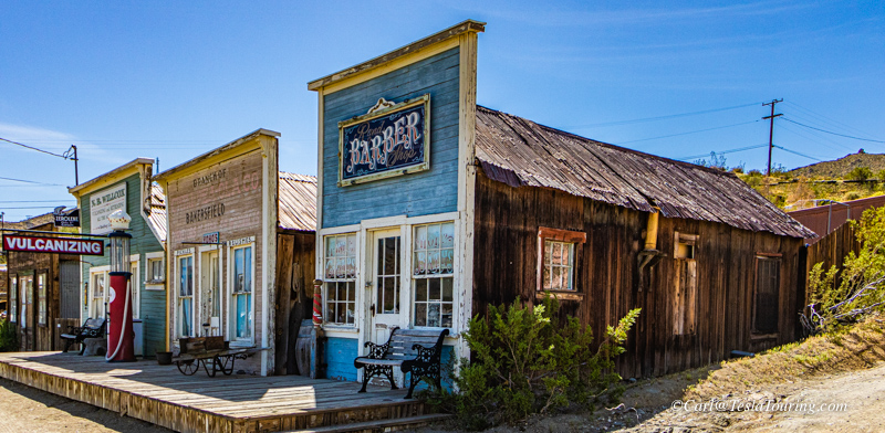
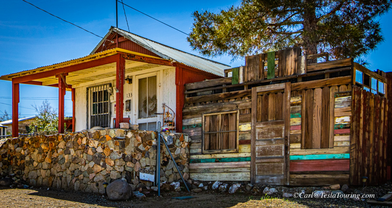
Some store fronts
look vintage.
But upon closer examination, they are only "putting on a good
front."
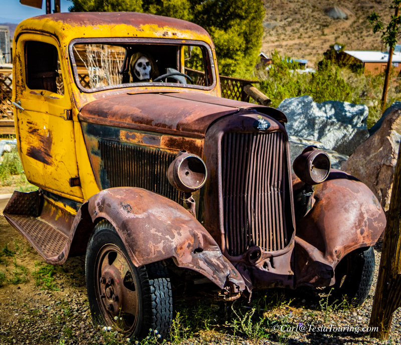
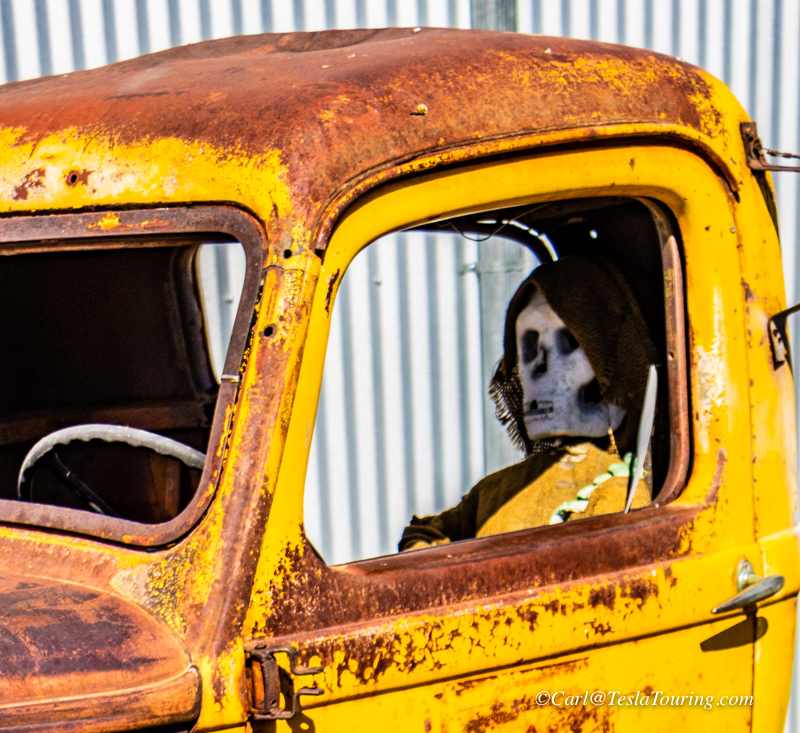
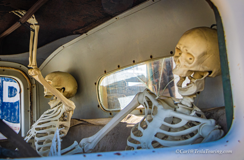
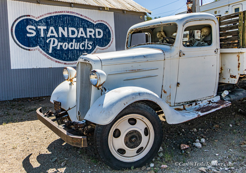
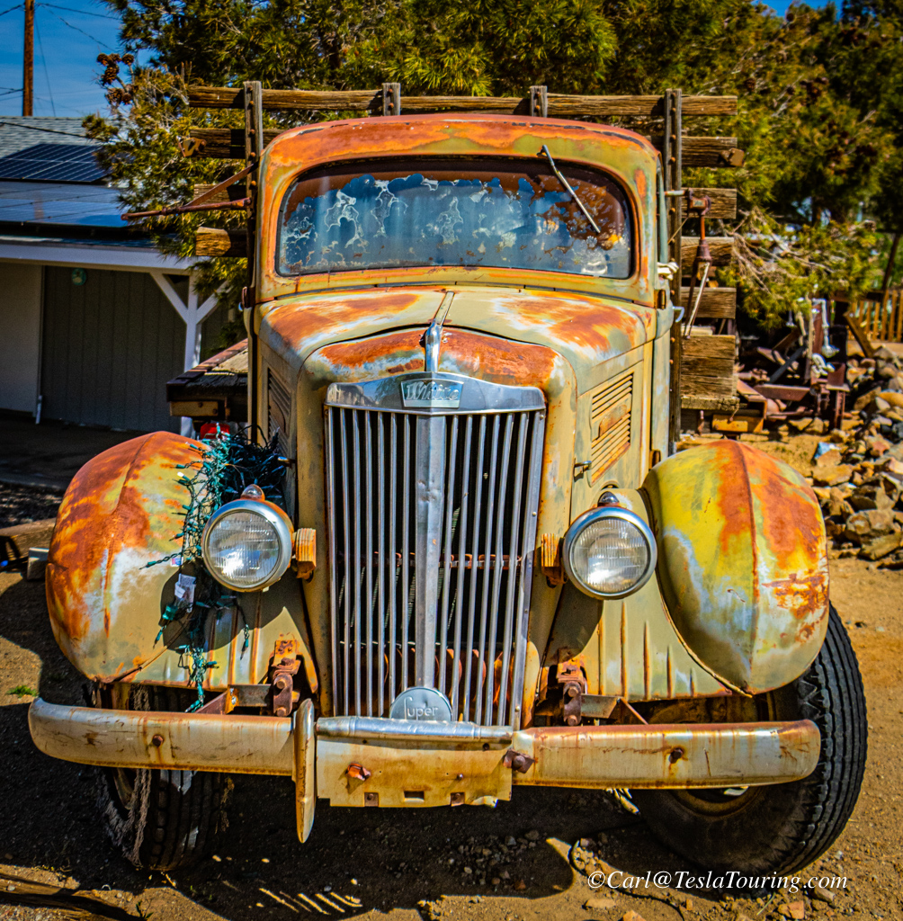
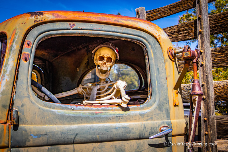
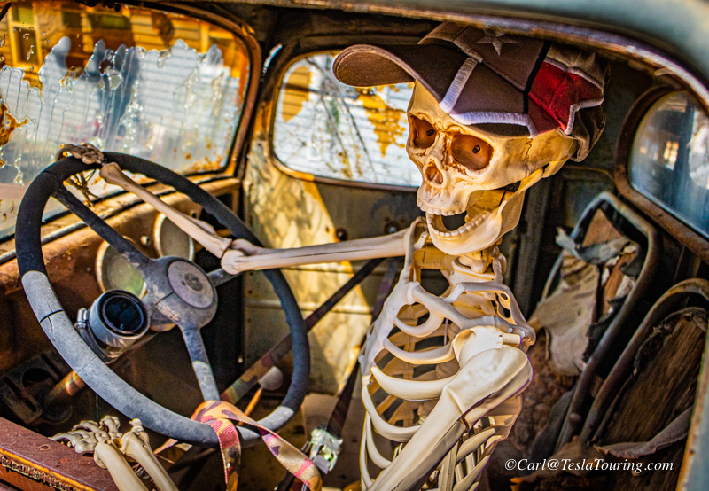
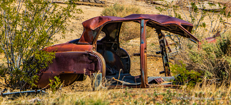
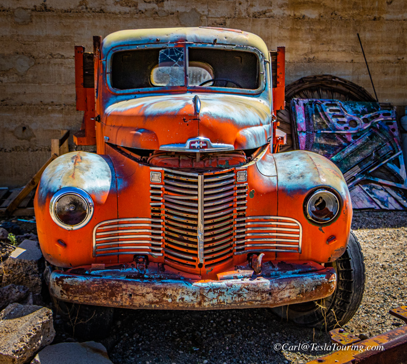
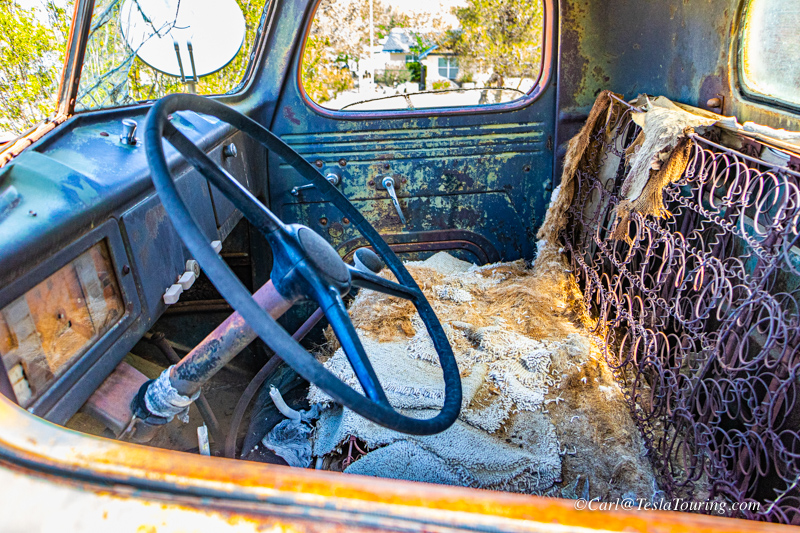
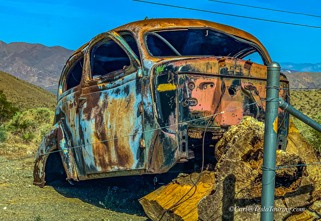
There seems to be a penchant for putting skeletons in old vehicles
around town.
Perhaps a leftover from the 1898
Randsburg Railway. Right, Some
vehicles have, nearly, been restored.
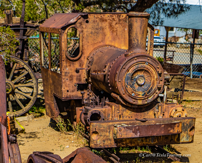
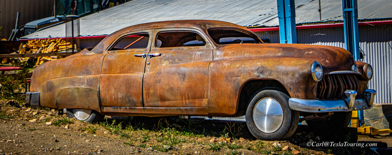
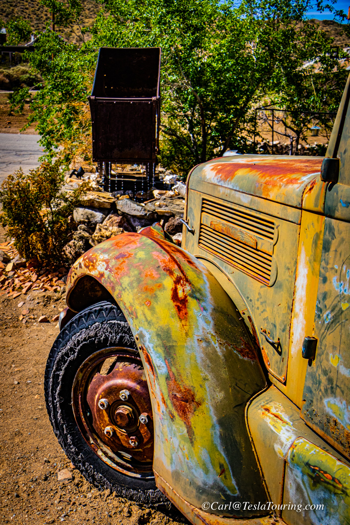
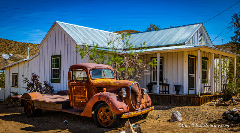
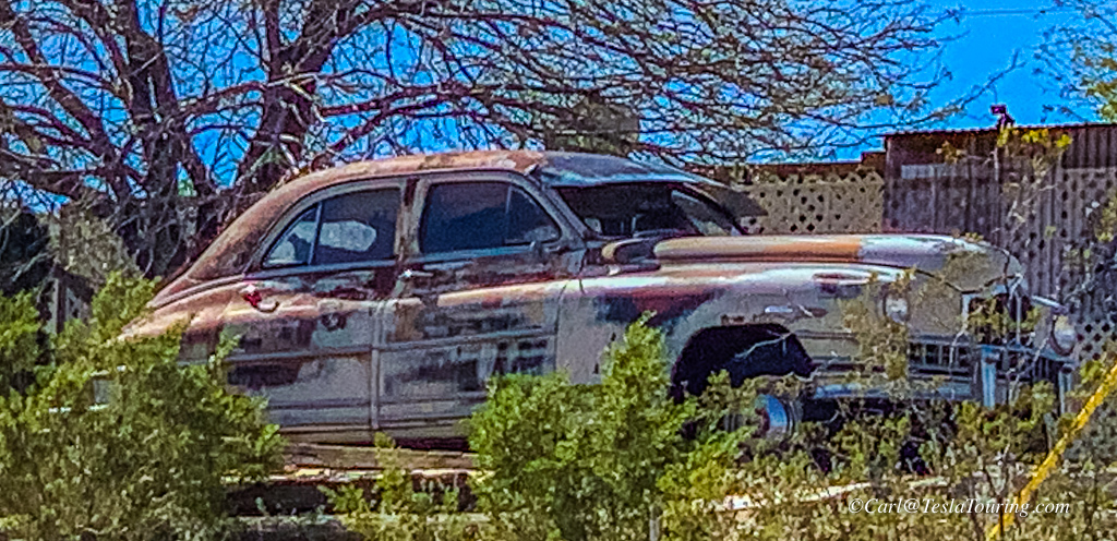
Other than rust, there were some colorful spots in town.
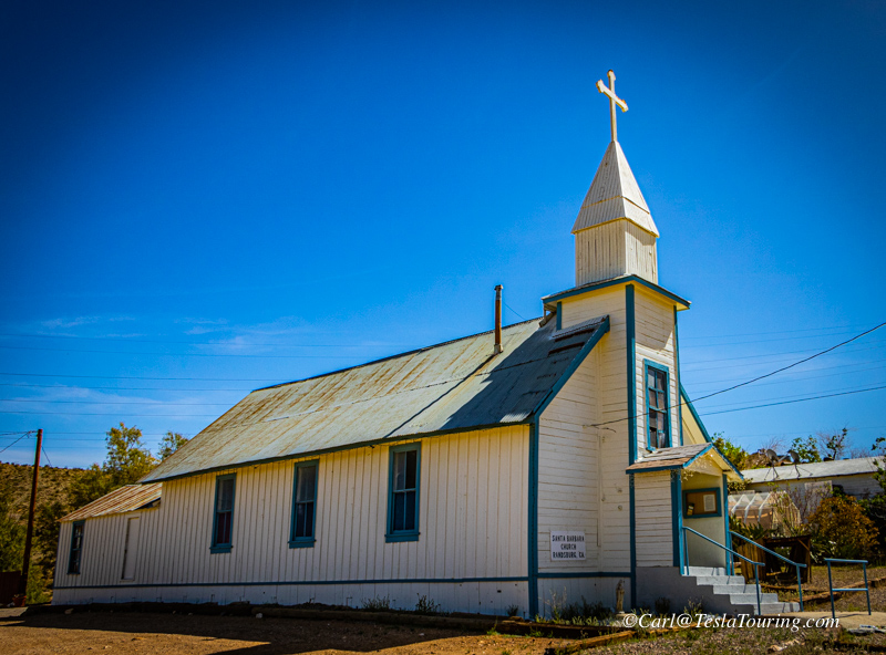
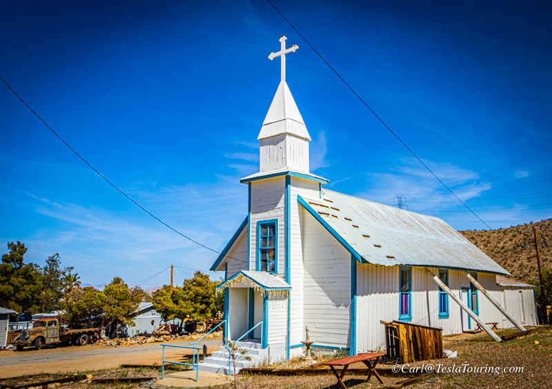
Santa Barbara Catholic Church Butte Ave.
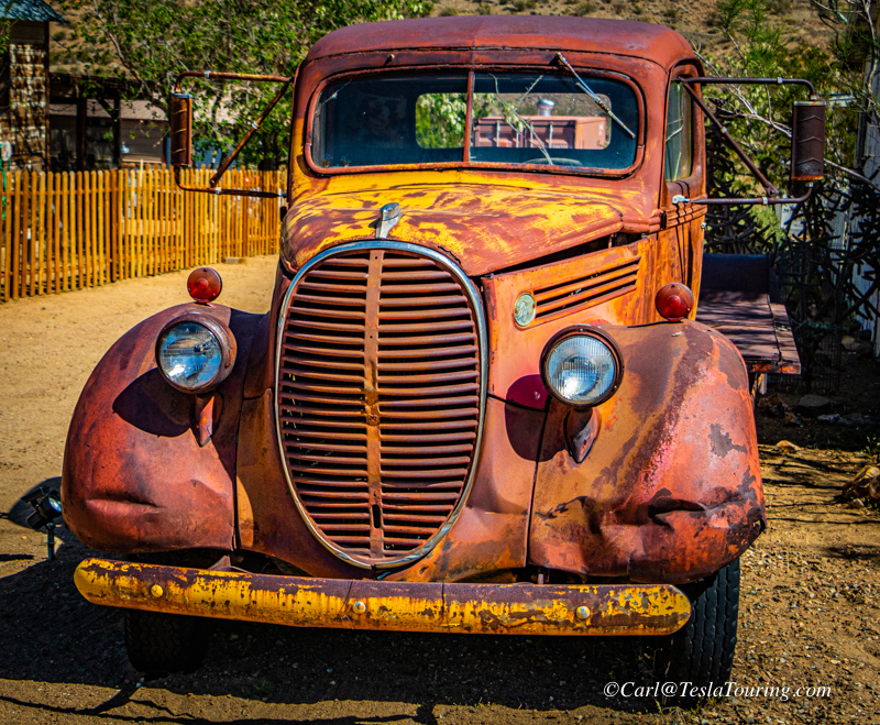
Some rusty vehicles need a few extra photos.
This may be my favorite Randsburg portrait.
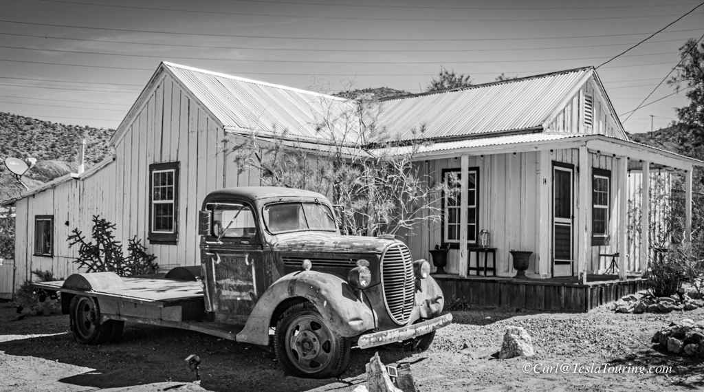
Some scenes favored a vintage black-and-white look.
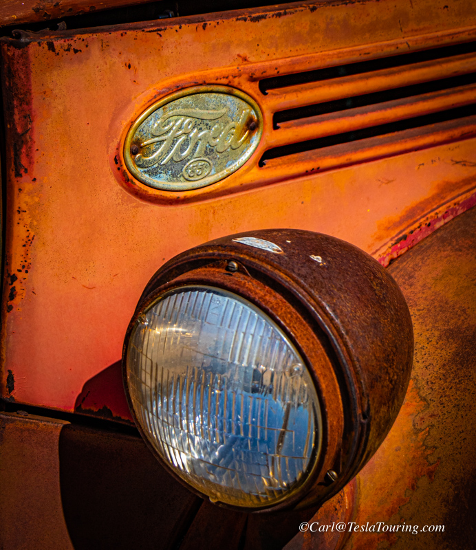
Some models need a 3-shot treatment. I once labeled a truck like
this: F.O.R.D. ...Found On Road Dead.
Southeast of town, on a high point, "R stands for Randsburg" and the
church steeple looking more noble from here.
Donna was eyeing this lofty abode, but reasoned that it was too small.
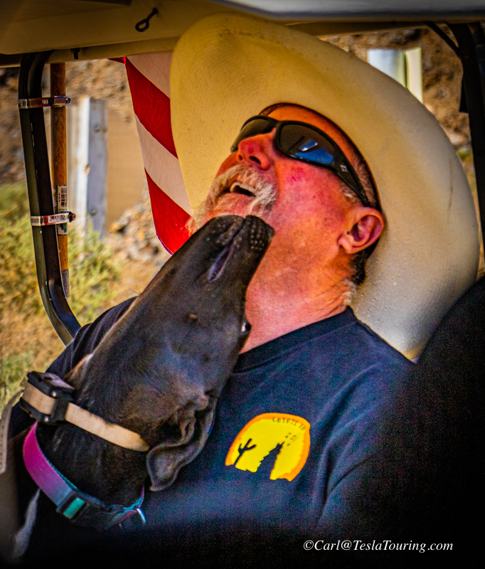
This
fellow mentioned that the population of Randsburg was 37 3/4 and he was
the 3/4 because he was a part time resident of 5 days a week, working
at a nearby military base on weekends. His dog was just showin' a
bit of love.
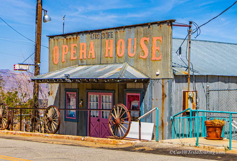
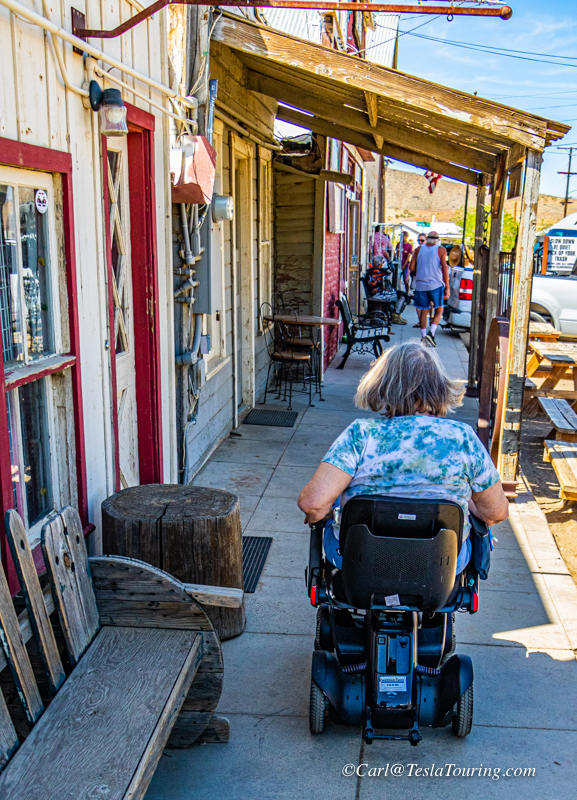
A popular
building to photograph on Butte Street.
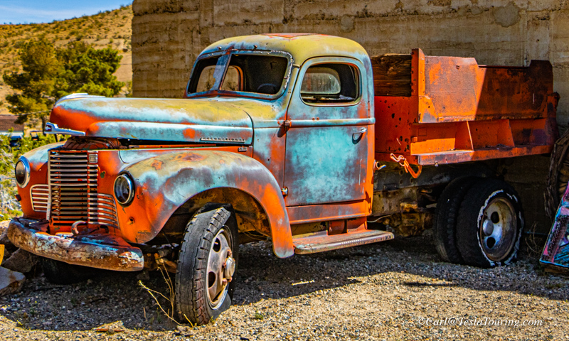
International brand dump truck.
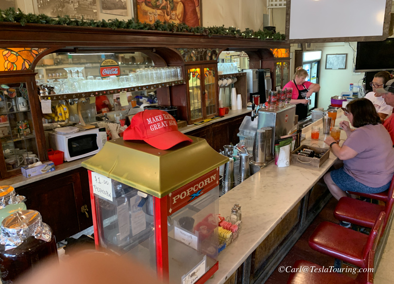
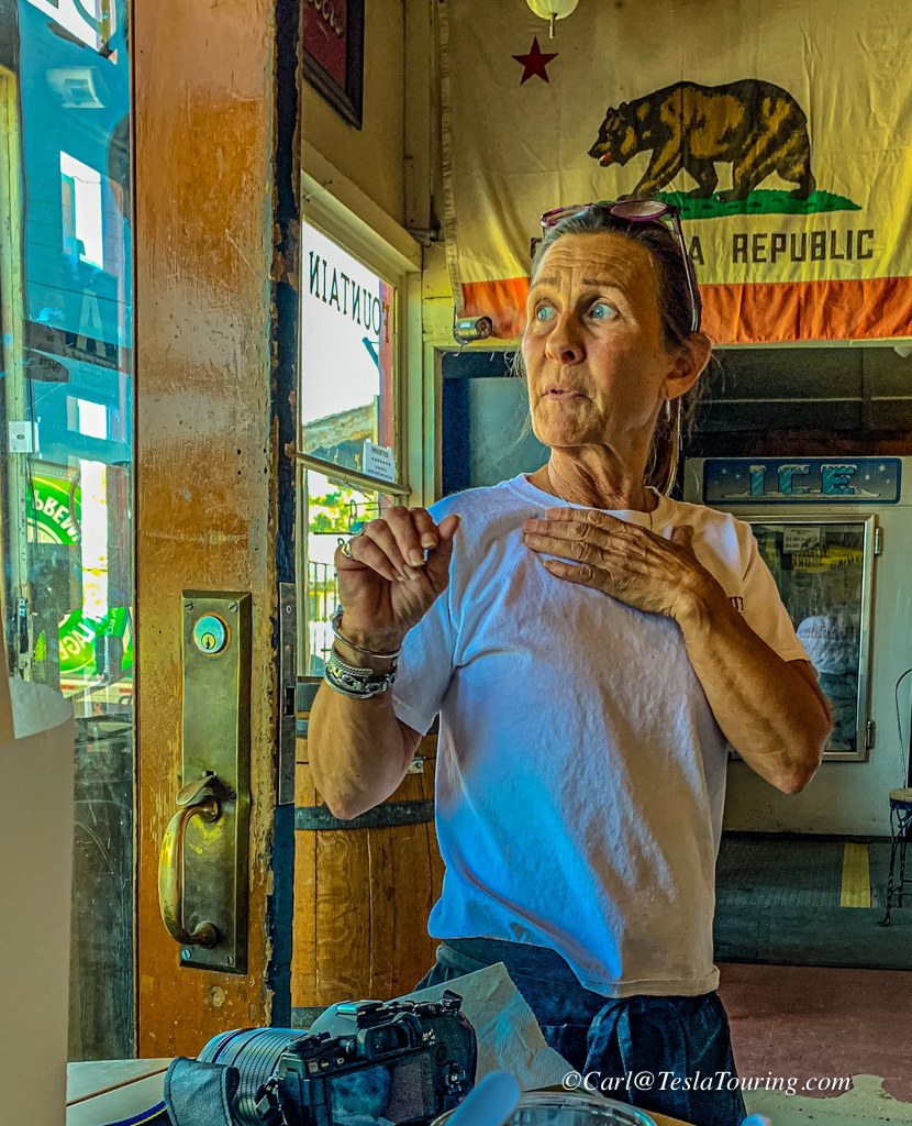
Eventually we made it back to the Country Store's lunch
counter.
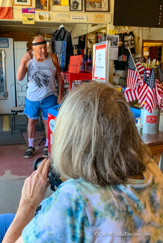
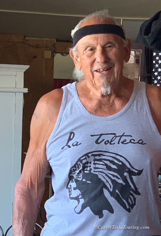
Donna spotted a good
photo model and asked if she could take his photo. I took a photo
of the store's proprietor, right .
Locals discussing a new tee shirt design at the Country Store.
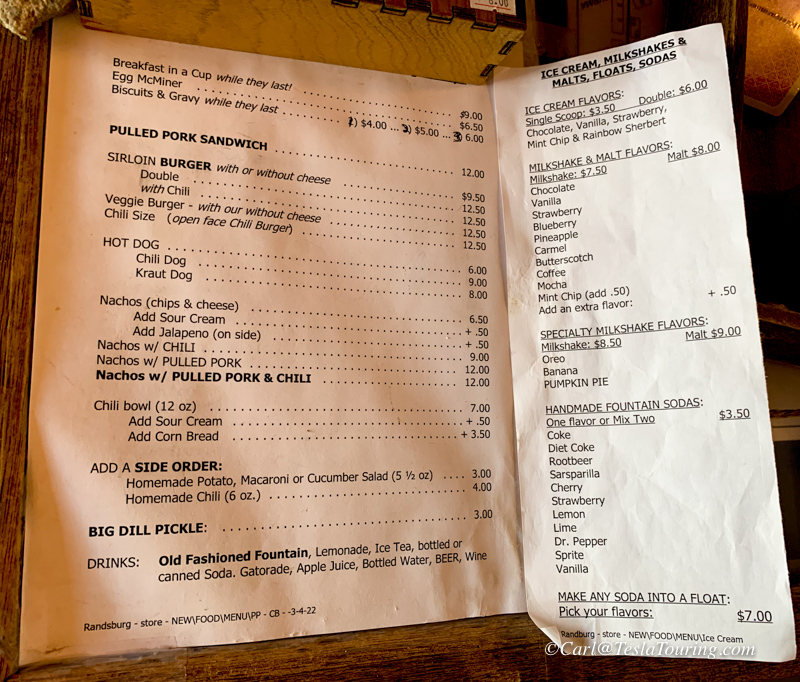
Click the menu for a larger, readable copy.
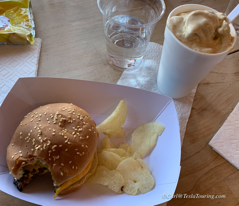
My hamburger ready for a second bite and the coffee malt on the
side. Both very good. Donna had Nachos with pulled pork,
enough for a group.
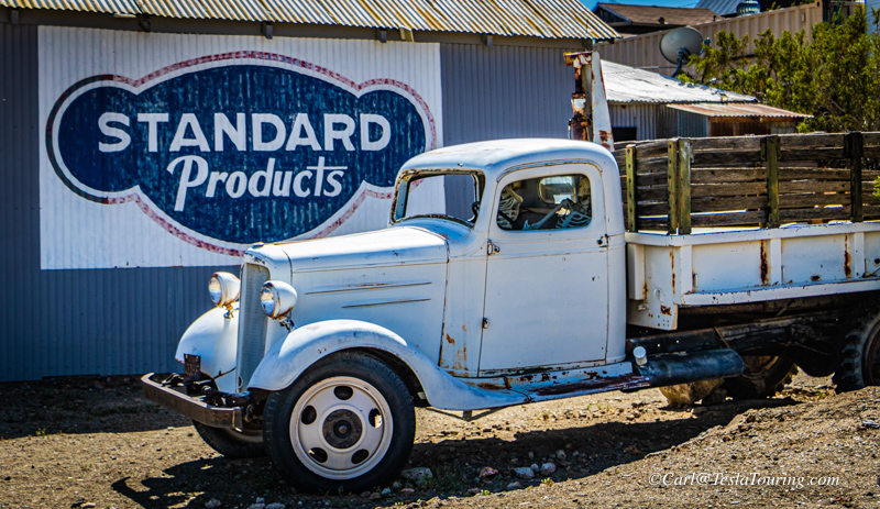
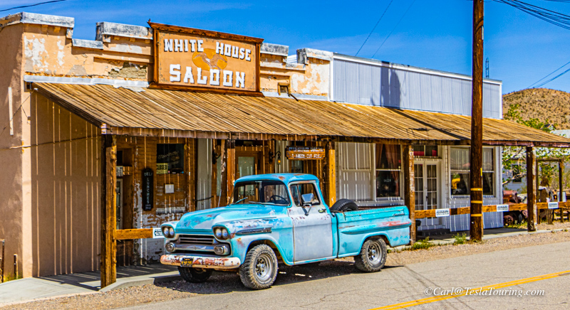
Some locals still have classics they drive into town. Not much in
this shot has changed since 1958 when the Chevy Apache pickup was new.
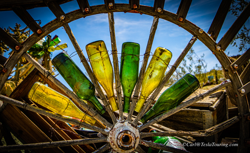
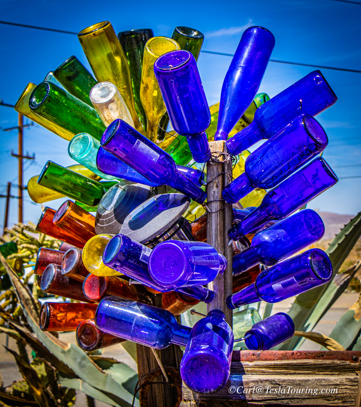
Colored bottles seem as popular for display in Randsburg as skeletons.
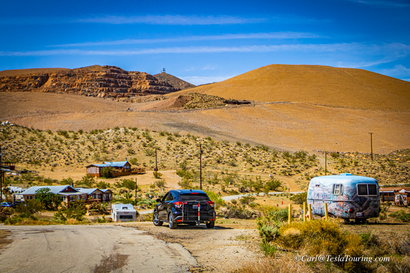
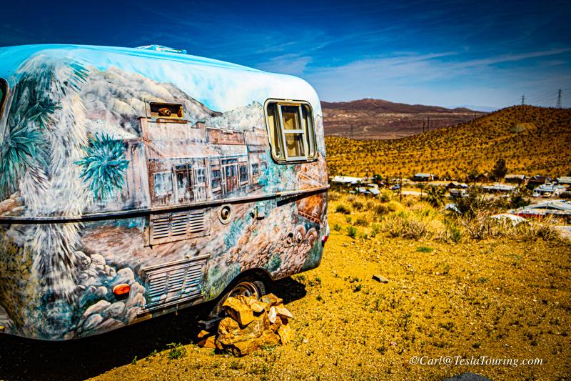
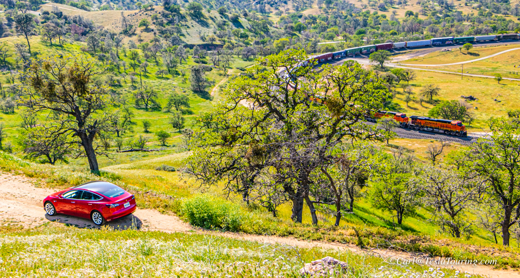
Juxtaposition of time - modern electric vehicle and ghost town antique
store.
Some shots from north of town toward Hwy. 395.
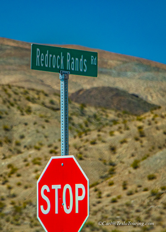
Time to head for Mojave to charge the Tesla then on to Tehachapi Loop
for some rail fanning. Stephen told me of a cut-across Redrock
Rands Rd. which saved me many miles.
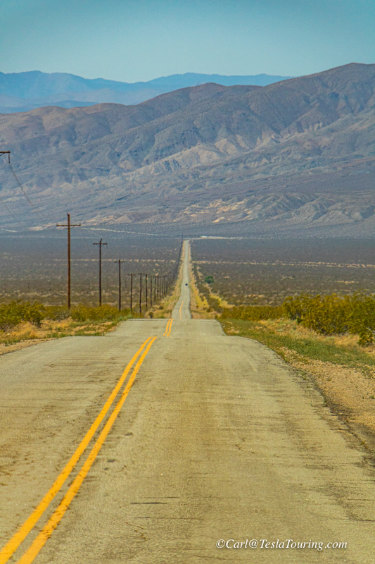
The road looked like Hwy. 50 in Nevada which is called, "The loneliest
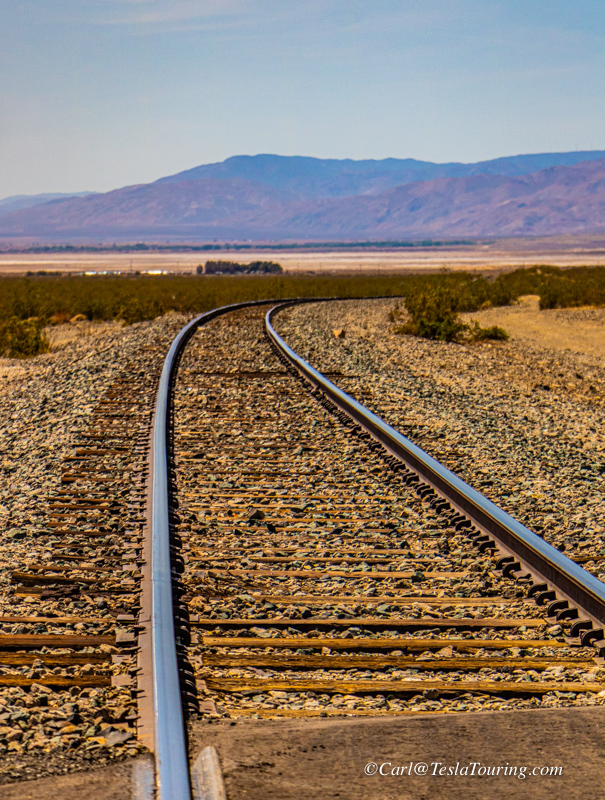
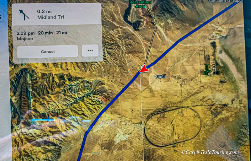
Road in America". I crossed a railroad which, from the GPS map on
my Tesla's screen, seemed to run into a circle.
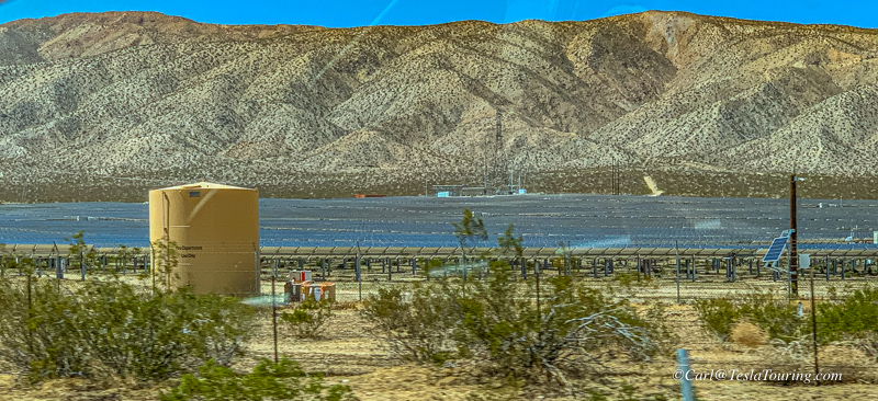
What looked like dry lakes from my car, turned out to be several very
large solar farms along Hwy. 14.
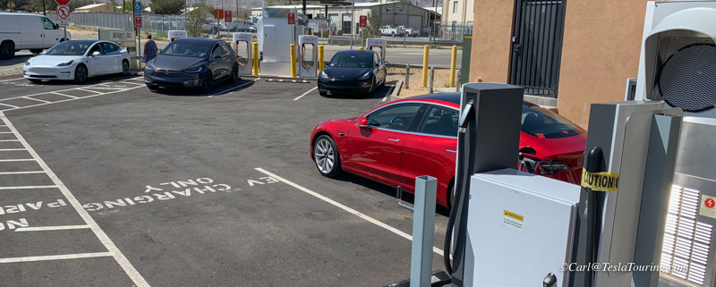
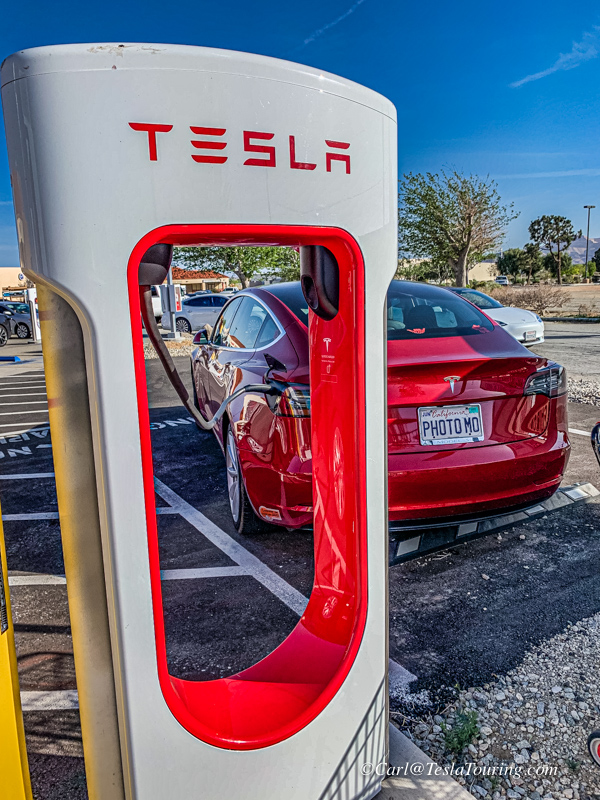
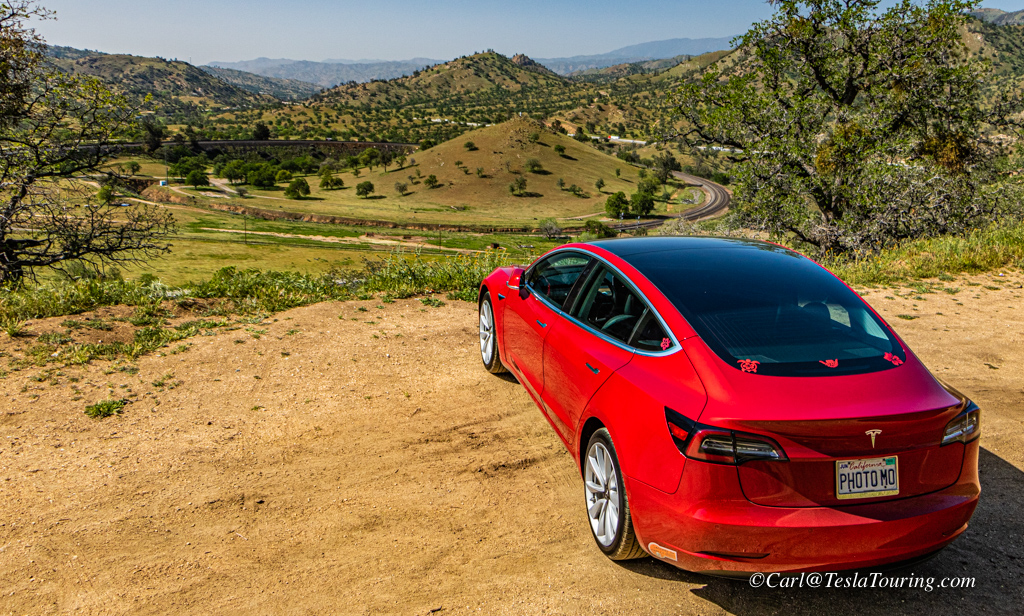
From the
Randsburg photo shoot, I drove to Mojave to charge the Tesla at the
Mojave Tesla Supercharger.
Any time there are newer chargers at a Tesla Supercharger, the newer
ones will be the most powerful, charge at one of the newer cabinets.
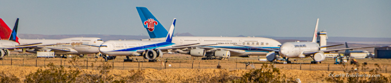
From the back of the center where the Mojave Tesla Superchargers are
located, you can get this view of the airplane graveyard.
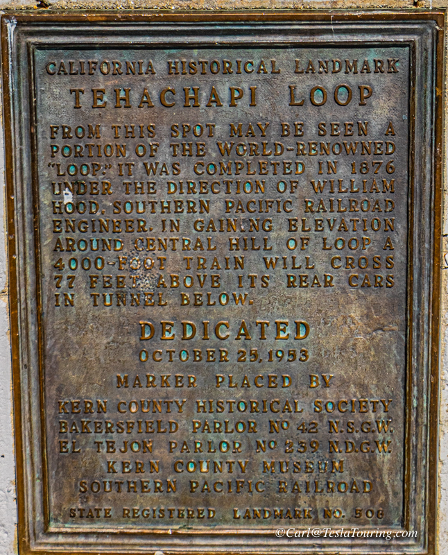
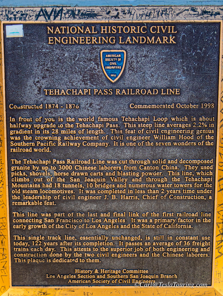
Tehachapi Loop
There is something in common between my electric car and trains.
Although commonly called "diesels," locomotives actually are
electrically driven. The diesel engine drives an alternator, which
produces electricity to run electric motors mounted on the locomotive's
axles. So my next stop on this day's outing was the Tehachapi
Loop to watch Diesel Electric Locomotives pull trains through the
Tehachapi Mountains and the historic loop.
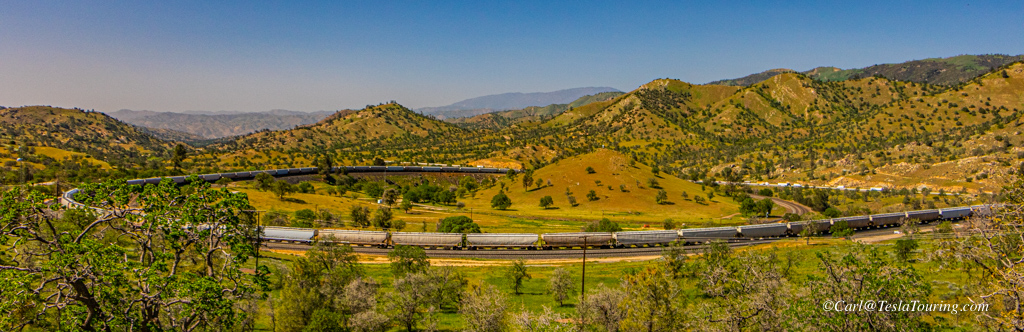
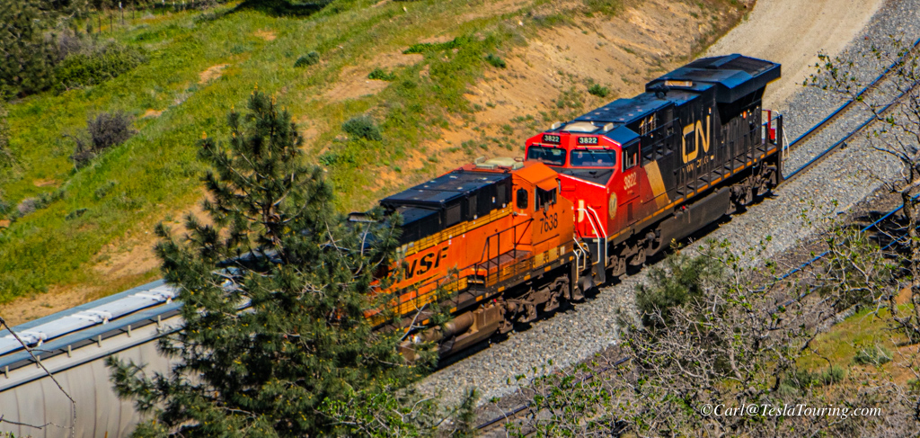
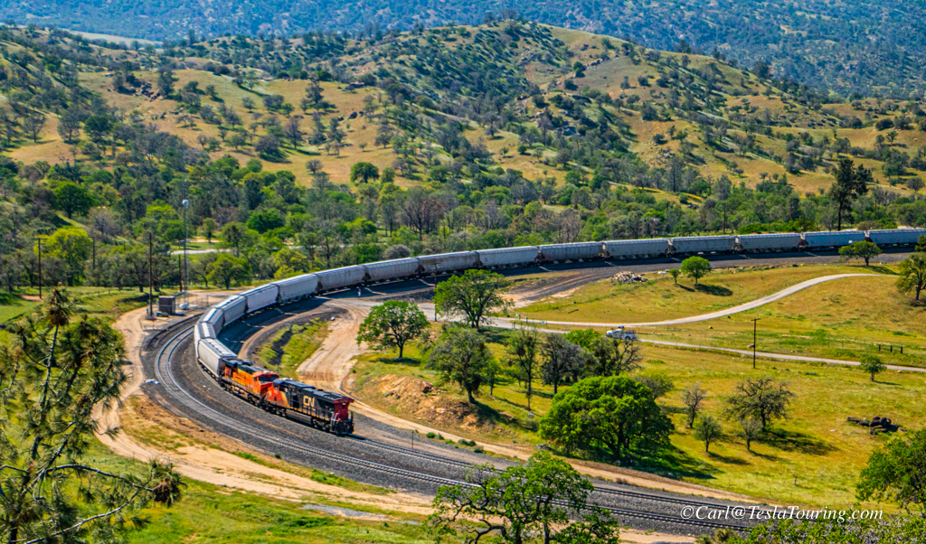
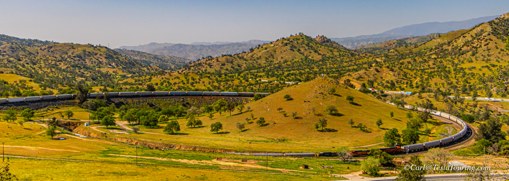
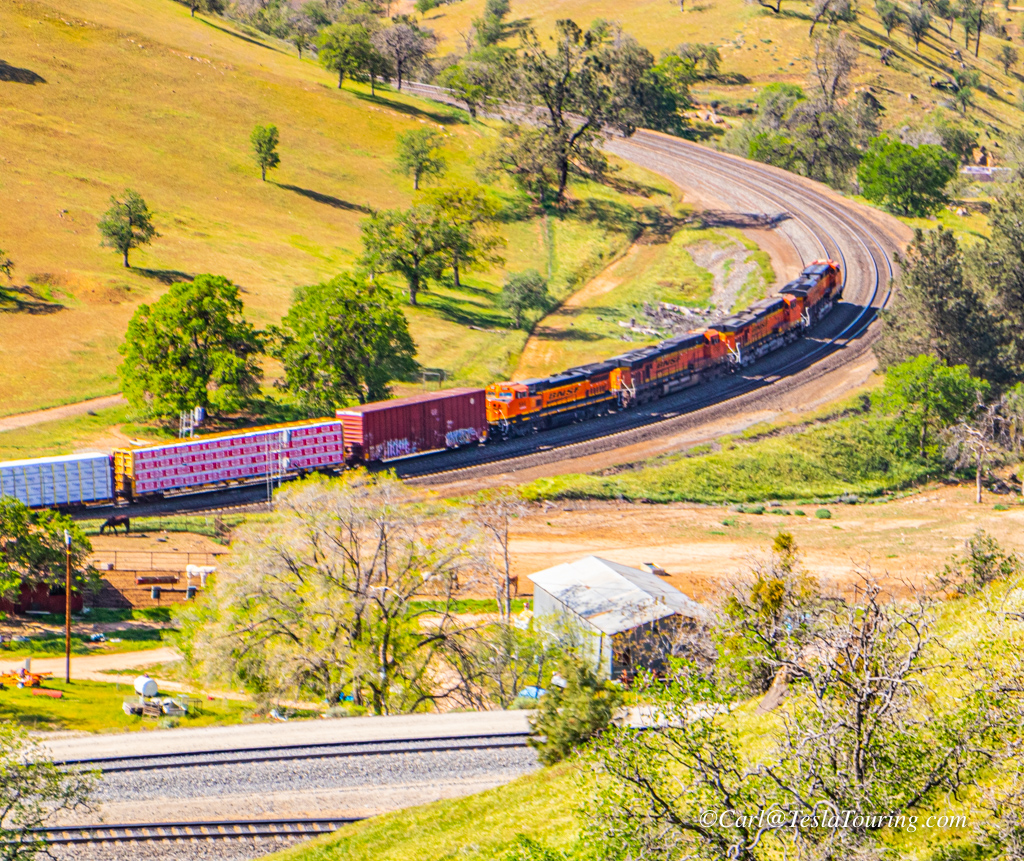
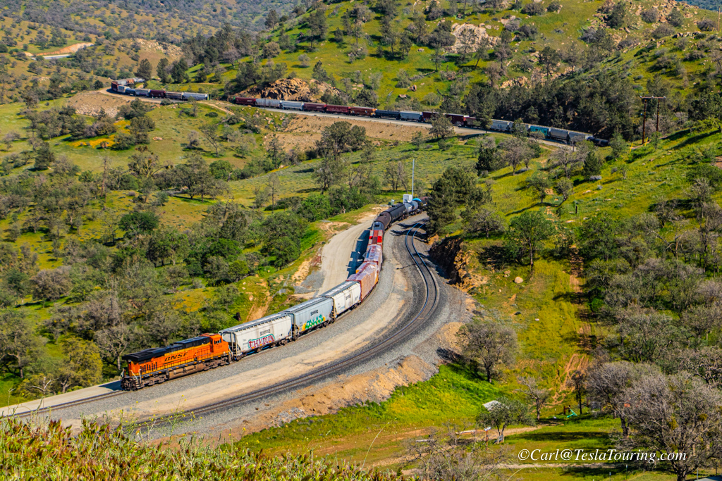
When I arrived at the historic Tehachapi Loop I found a container train
stopped in the loop. This gave me an opportunity to photograph a
stationary train on the loop to illustrate the geography.
Click any photo to have a larger, more
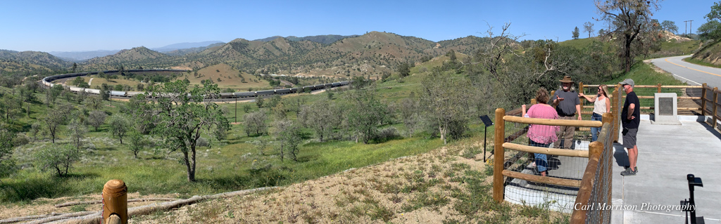
readable copy; click back arrow to return to this page of the report. There is a new
overlook of the loop with safe parking and overlook with two historic
plaques.
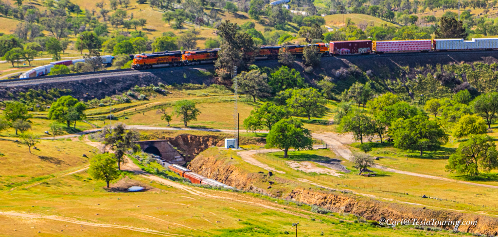
I drove past one hill east of the overlook and found the locomotives
for the stopped train. While photographing them, they started
moving to the left. This meant that they were pushers, so I
returned to the overlook to see this train leave the loop.
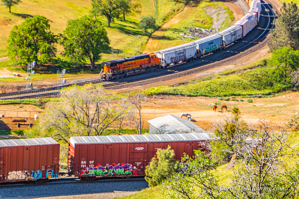
The Grain Train being pushed
through the loop. These cars seem to be 5150 cubic foot,
286,000 GRL (Gross Rail Load) Covered Hoppers great for grain, corn,
rice, soybeans.
Why do long freight
trains have pushers/helpers?
It is called distributed power units (DPU's)
One on the back is basically a pusher to help get over some high grades
or long grades where it would put to much of a strain on the train cars
especially if there is curves in the grade.
To reduce drawbar forces. Trains have limitations for tonnage,
especially on mountain grade territory. The mid- or rear-end helpers
prevent the train from breaking in two.
I also read that the distributed power units on curves like the
Tehachapi Loop are used because a long train might turn the inner rail
over if DPUs were not used. Also, couplers might break in a
train too long.
From: https://ogrforum.ogaugerr.com/
Correction: APRIL 8
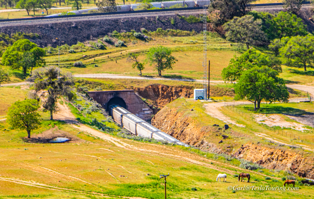
Trains heading west
come around the knoll, right, and enter a tunnel, below, under the back
of the train and head on west.
Trains heading west come around the knoll, right, and enter a tunnel,
under the back of the train and head on west.
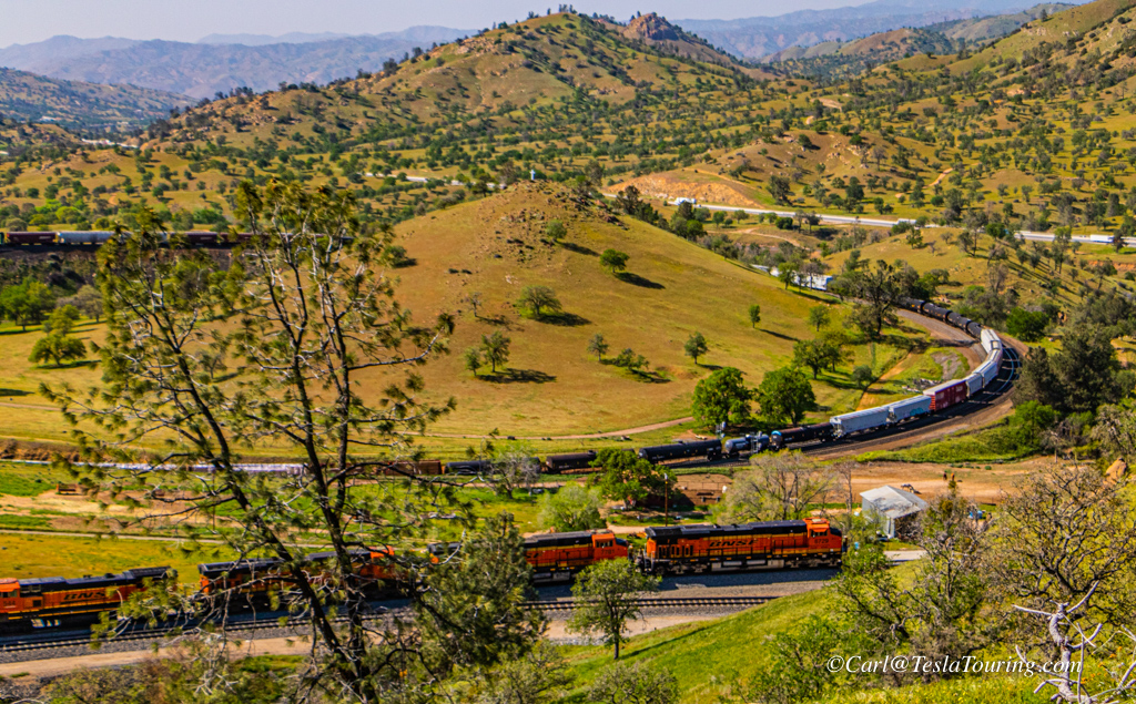
Before the next train arrived, this time from the west, I moved my car
up a one-lane dirt road to an excellent vantage point of the
loop. There was a turn around point complete with a picnic table
and trash barrel.
At about 3:55 the lead locomotives entered the loop. The photo
above right shows the lead locomotives about to cross the entrance
tunnel with the rest of this train still approaching the tunnel from
the west.
The whole loop with the locomotive past the entrance tunnel.
A closer look at the locomotives as they leave the loop with the rest
of the train still coming into the loop.
A mixed train like this makes a much more interesting photo than the
earlier hopper train where each car is identical to all others.
Finally the end of the train and its one pusher. 4:02 pm
I climbed the hill above my car and watched the train move on east
after it curved around the hill I was on. Note the
double track, but the tunnel in the loop is single rack causing quite a
bottleneck.
.
Correction, APRIL 8.
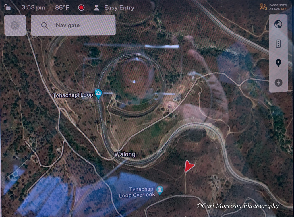
Tesla's GPS screen showing the car's location - red triangle. It was
time to take Big Red back to Mojave for more charging, then on to
Palmdale for the night. The next morning would the the PSA photo
event.
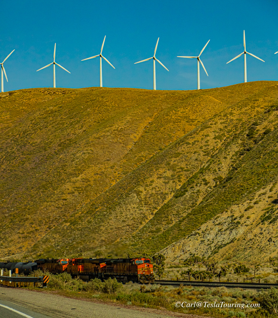
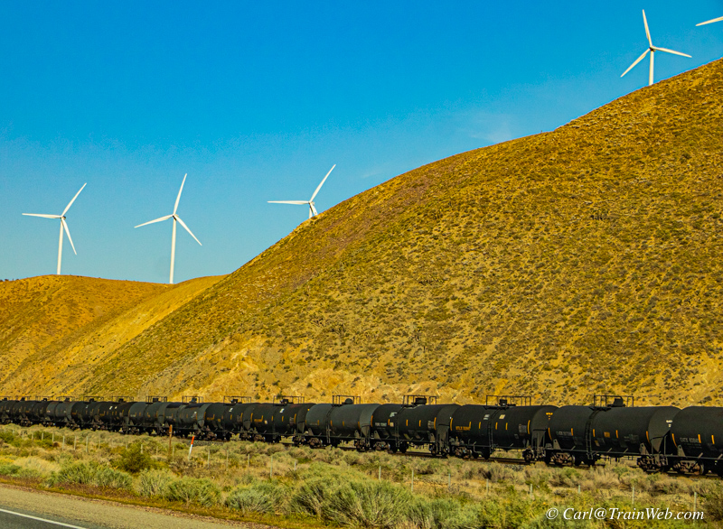
Heading east from the town of Tehachapi, the same railroad parallels
Hwy. 58 and I met 2 or 3 freights. There were also many wind
turbines. I thought the juxtaposition of oil tank cars and wind
turbines was timely with the world trying to change from fossil fuel.
I left the photo
conference in Palmdale and looked for the 3rd time in the day and
noticed there were still no open/working chargers at the Palmdale Tesla
Supercharger. Always charge an extra 30% more than it takes to
get to your chosen charger destination. I simply asked the Tesla
computer to show the Tesla Superchargers on my route and selected Santa
Clarita, charged to 123 miles of range for the 86 miles to my home.
Arrived home safely after an excellent Friday and Saturday of
photography. My notes revealed this summary of Tesla Travel
Statistics:
Miles driven - 391. Cost of supercharging for these 391 miles was
$25.96. Average time spent charging at the 5 charging
stops: 13.6 minutes per charge.
Thank you
for reading my report. Check out my other reports: